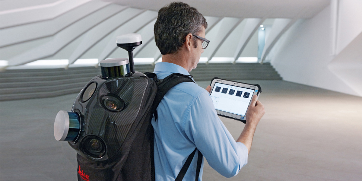
The Leica Pegasus:Backpack is an award-winning wearable reality capture sensor platform. A
highly ergonomic design combines five cameras offering fully calibrated 360 degrees view and
two LiDAR profilers with an ultra-light carbon fibre chassis. It enables extensive and efficient
indoor or outdoor documentation at a level of accuracy that is authoritative and professional.
This unique mobile mapping solution is designed for rapid and regular reality capture. It is
completely portable, enabling it to be checked in as luggage on a flight. The Pegasus:Backpack
is designed to act a sensor platform with our standard external trigger and sync port outputs.
The Pegasus:Backpack makes progressive professional BIM documentation a reality. It synchronises imagery and point cloud data, therefore assuring a complete documentation of a building for full life cycle management. By using SLAM (Simultaneous Localisation and Mapping) technology and a high precision IMU, it ensures accurate positioning with GNSS outages.
Knowing and understanding a landscape before rushing into emergency situations can save lives. Document any site in 3D models and images for fast, safe and efficient response. Combined with Autodesk, Intergraph and other software, reality-based industrial training is enhanced with the most accurate and current data sets.
The Pegasus:Backpack helps you to make better and faster decisions in emergency situations due to access to more accurate data. Evacuation plans and route mapping benefit from clear and detailed images and point clouds that alert authorities to any changes. Access densely populated areas, providing accurate and current mapping to give city authorities a clearer and deeper understanding of the situation.
For the first time, responders to natural disasters can capture disaster area data in 3D on foot. Faster response times translate into lives saved and damage minimised. Capture the critical data needed to make faster and better informed decisions that increases chances of survival and reconstruction.